Route 66 - Roadmap - Missouri - Part 2
These towns are traversed on Route 66 in Missouri
St. Louis – Southhampton – Shrewsbury – Marlborough – Crestwood – Sunset Hills – Valley Park – Wildwood – Eureka – Allenton – Pacific – Villa Ridge – Union – Moselle – St. Clair – Anaconda – Oak Grove – Sullivan – Bourbon – Cuba – Fanning – Rosati – St. James – Dillon – Rolla – Doolittle – Arlington – Jerome – Waynesville – Lebanon – Philipsburg – Conway – Sampson – Niaguna – Marshfiled – Holman – Strafford – Springfield – Elwood – Yeakly – Plano – Halltown – Paris Springs Junction – Spencer – Heatonville – Albatross – Phelps – Rescue – Plew – Avilla – Red Oak II – Carthage – Brooklyn Hights – Carterville – Webb City – Joplin
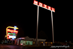
Waynesville – Lebanon
Behind Hooker and Jerome leave the Highway Z, to drive to the Devil’s Elbow. Follow the Route 66 signs. The road at this point is in a very bad condition. Drive over the Big Piney River. At the end of the road bending to the left again onto Highway Z. It is possible to leave out the side trip to Devil’s Elbow, but it is a nive one. Stay on Highway Z until it ends, then follow in St. Robert the Business Loop I-44th Follow the I-44B through Waynesville, go straight ahead, follow the SR-17th The street is called again officially Old Route 66 due to the SR-17, cross the I-44, go to the other side of I-44 on. The 17 bends away to the left, follow Hwy AB towards Hazlegreen. Drive parallel to I-44 on the right. Follow Glacier Point Road until you have the I-44 cross again. Drive on the Pecos Drive to Lebanon, MO.
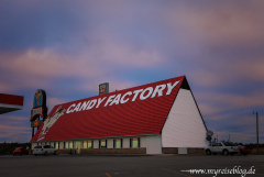
Lebanon – Philipsburg – Conway – Sampson
From Lebanon follow Hwy W, parallel to Interstate 44 to south. Exit the Highway W at Phillipsburg on Highway CC. Located off Interstate Junction – Exit 118 you will find the “Candy Factory” and the “World’s Largest Gift Store”. Drive through Phillipsburg on Hwy CC to Conway. Stay always on Hwy CC parallel to the railway line. The Highway CC goes stright to Sampson, MO.
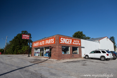
Niaguna – Marshfield – Holman – Strafford – Springfield
In Niaguna follow Hwy CC, ride over the East Fork River, in Marsfield always follow the Highway CC. The route is well signed. Behind the village Marsfield follow the SR-38 North. At the next junction follow the Highway OO. Holman is the next town on Highway OO. Drive trough Strafford on Hwy OO or SR-125. Behind the town the road divides. Hwy OO and SR-125, follow Hwy OO straight. You reach Springfield, MO.
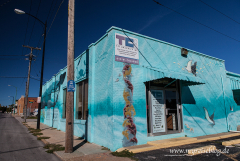
Springfield – Elwood – Yeakly – Plano – Halltown – Paris Springs Junction
In Springfield, the Route 66 runs through the town, follow the brown signs or use bypass around Springfiled on the I-44th. Follow SR-266 West, this leads to Elwood. Always follow SR-266 to Halltown and behind. In Halltown there are a few Route 66 attractions, these are all on Route 66 Highway. Stp at “Whitehall Mercantil”, a very old country store in Halltown.
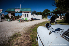
Spencer – Heatonville – Albatross – Phelps – Rescue – Plew – Avilla – Red Oak II
Drive behind Halltown further on SR-266 , you reach Paris Springs. In Paris Springs visit “Gary Gay Parita Station”, an old gas station with a lot of Route 66 history. Drive on Route 66, this route is signed and leads to Spencer. In Spencer you can find an old “Philips gas station.” Drive on Hwy 96 (Historic Route 66). Follow Hwy 96 to Heatonville, then go through Albatross, Plew and Avilla. At the intersection with Highway 120 turn right and drive to “Red Oak II”. If you have stopped at Gray Turner, you get with a detailed map how to get to Red Oak II.
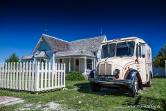
Red Oak II – Carthage – Brooklyn Hights – Carterville – Webb City – Joplin
Leave Red Oak II drive back onto Highway 96 and follow the Historic Route 66 to Carthage. In Carthage there is the beautiful Courthouse and the “Boots Motel”. Behind the town follow Highway 571, Old Route 66, there you will pass a drive-in theater. Follow always Old 66 Boulevard to Cartersville. Follow the Highway HH leading to Webb City. In Webb City you can find the “Praying Hands”. Follow the Highway 71B up to Joplin, MO.
St. James, Missouri – Joplin, Missouri
Bigger Map
The Route 66 in Missouri is 317 miles or 511 km long
All data I give to you has been researched to the best of my knowledge and belief. Nevertheless, to me, of course, be a mistake. In addition to my information, please use always current maps or guidebooks..
